Work on major light rail transit route in Mississauga ramps up near important creek
Published August 3, 2022 at 10:40 am

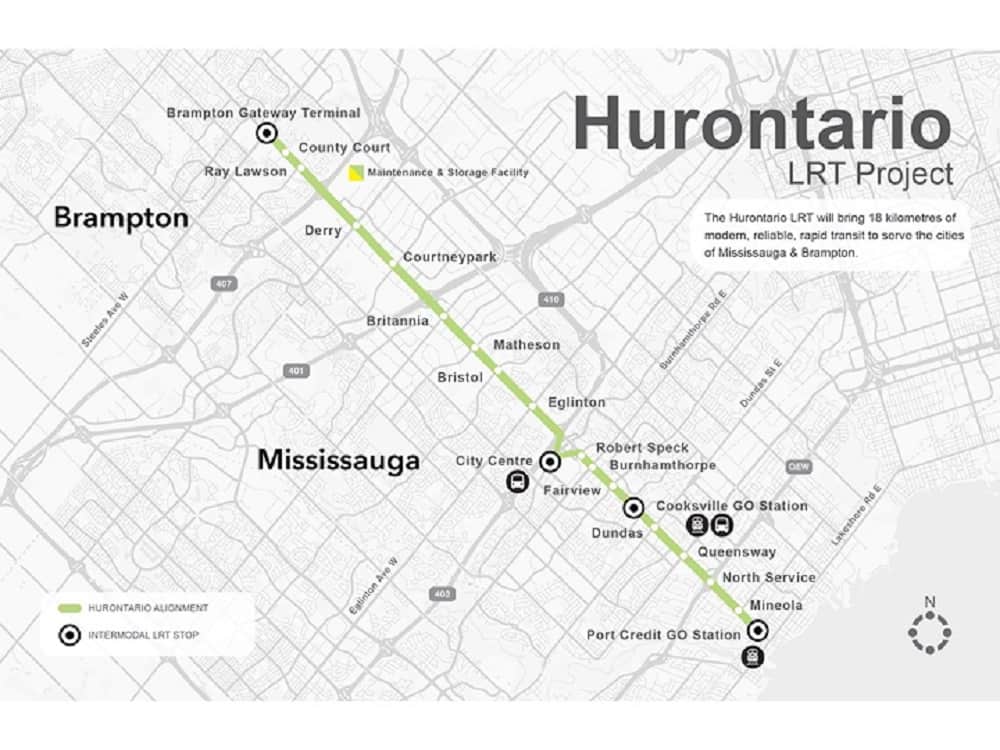
Crews working on a $1.4-billion light rail transit (LRT) route that will run from the south end of Mississauga north into Brampton have been busy lately completing environmentally sensitive tasks around an important watercourse.
Recent work on the 18-kilometre Hazel McCallion LRT, which is to be completed by fall 2024, has focused on a section of 100-year-old Mary Fix Creek near Port Credit GO station.
Port Credit GO is the starting point of the LRT route, which when up and running will make 19 stops between south Mississauga and Brampton.
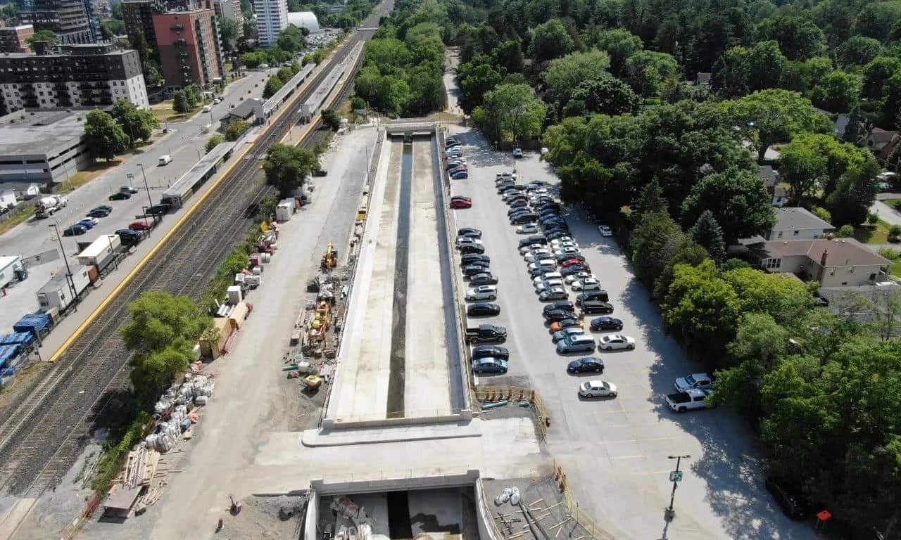
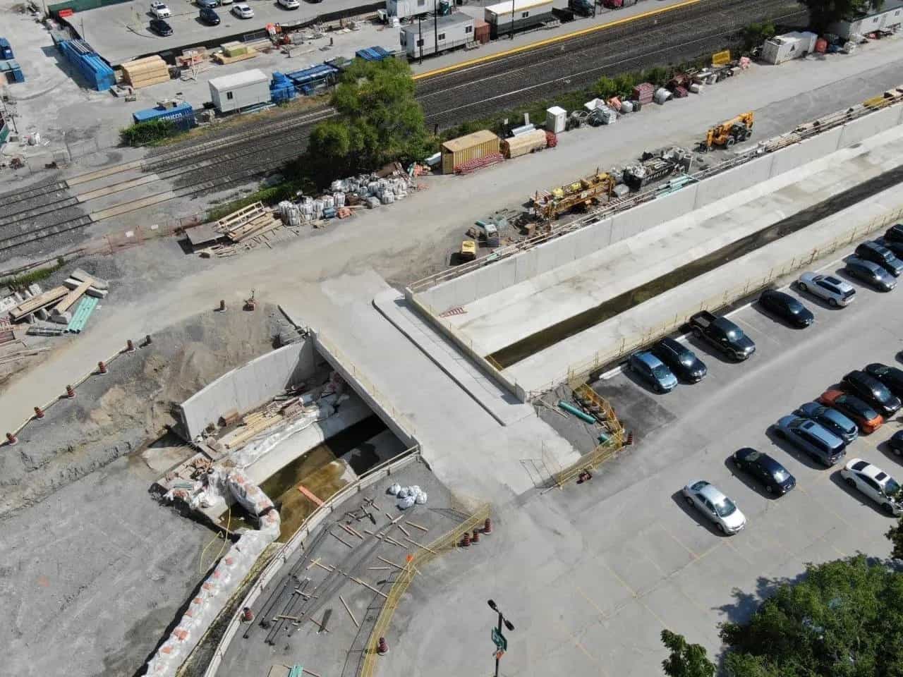
“On the east end of the creek, construction on flood walls is underway. The team has redesigned the canal so that it’s wider, with higher flood walls. This way, it will have more protection against weather impacts,” project leaders at Metrolinx, the provincial agency overseeing the huge undertaking, said in a news release today (Aug. 3).
“While flood walls are in construction, crews have ensured that work does not damage the creek. Sandbags are used to divert Mary Fix Creek to one side, allowing construction of the flood walls to continue without disturbing water flow.”

Aerial view of the Mary Fix Creek east bridge. (All photos: Metrolinx)
Named for a local pioneer, the creek flows from the Mavis Rd./Eglinton Ave. area in central Mississauga, then parallel to Hurontario St. south of the QEW before emptying into the Credit River at the CN bridge in Port Credit.
“This creek plays an important role in the city’s water infrastructure,” Metrolinx said, noting work crews are using extreme care around the creek.
Earlier this year, work was completed on the west bridge of the creek. Pedestrians will use that bridge to cross the creek to enter the Port Credit GO station, officials say.
Meanwhile, crews have also been busy in recent days and weeks completing other crucial work in and around Port Credit GO.
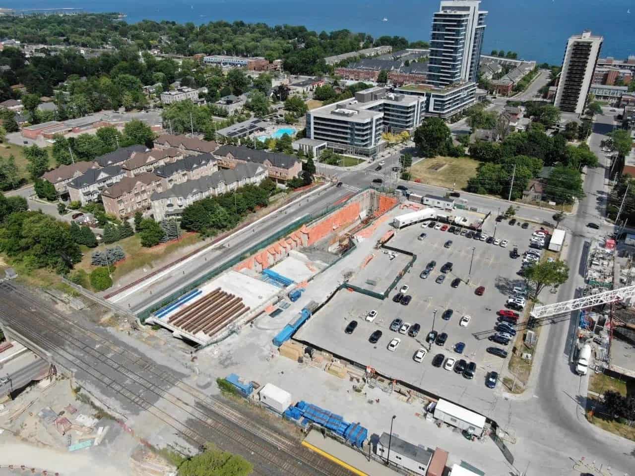
“At Port Credit GO station, the team is working on ensuring that the light rail vehicles (LRVs) will be able to connect to the station. To do so, they are pushing under the tracks using the Lakeshore West ‘push box,’ a large, hollow concrete box that’s pushed underground to create a tunnel,” Metrolinx said. “This will serve as the underpass for the LRVs to get into Port Credit station.”

Aerial shot of the Port Credit GO parking lot. Orange area in centre of photo shows where work is being completed on the underground station.
A similar “push box” will connect the underpass along northbound Hurontario St. at the QEW so LRVs can make their way through.
Additionally, a large section of Hurontario St. in that part of the city is going to look somewhat different for the next year or so to drivers and pedestrians.
Officials say a new traffic configuration known as a “traffic flip” will be used between Park St. (just north of Lakeshore Rd.) and Harborn Rd. (just north of the QEW).
The alteration will change the way traffic flows along that section of Hurontario St.
Officials say it’s necessary in order to accommodate construction of new utility infrastructure including watermains, storm and sanitary sewers, as well as hydro and telecommunications.
When completed, the new LRT line will connect to major transit systems including GO Transit (Milton and Lakeshore West Lines), the Mississauga Transitway, Brampton Transit, ZUM and MiWay.
City of Mississauga officials are still aggressively pushing for reinstatement of initial plans to create an “LRT loop” that would more directly and conveniently serve condo residents and office workers in the city’s downtown core around Square One.
The massive transit project reached a milestone several weeks ago when “guideway construction” along the route began. The guideway, project officials say, is the bed for the rail tracks.
In late June, Metrolinx launched a major public information campaign targeting residents, business owners and others who have questions about the project.
Metrolinx has sent out an “engagement team” and plans on using pop-up events throughout the summer to provide people along the Hurontario St. corridor with as much information as possible.


