VIDEOS & PHOTOS: Flood waters in Brampton force evacuations
Published February 18, 2022 at 11:27 am
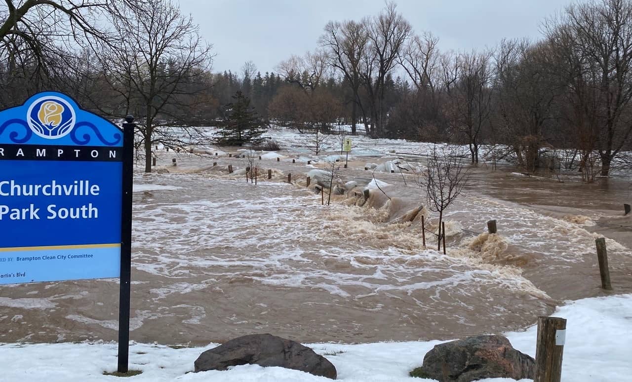
Brampton residents evacuated due to sudden flooding are still waiting for word on when they can return home.
Officials say the flooding started around noon on Thursday (Feb. 17) as an ice jam and rain caused parts of the Credit River to overflow.
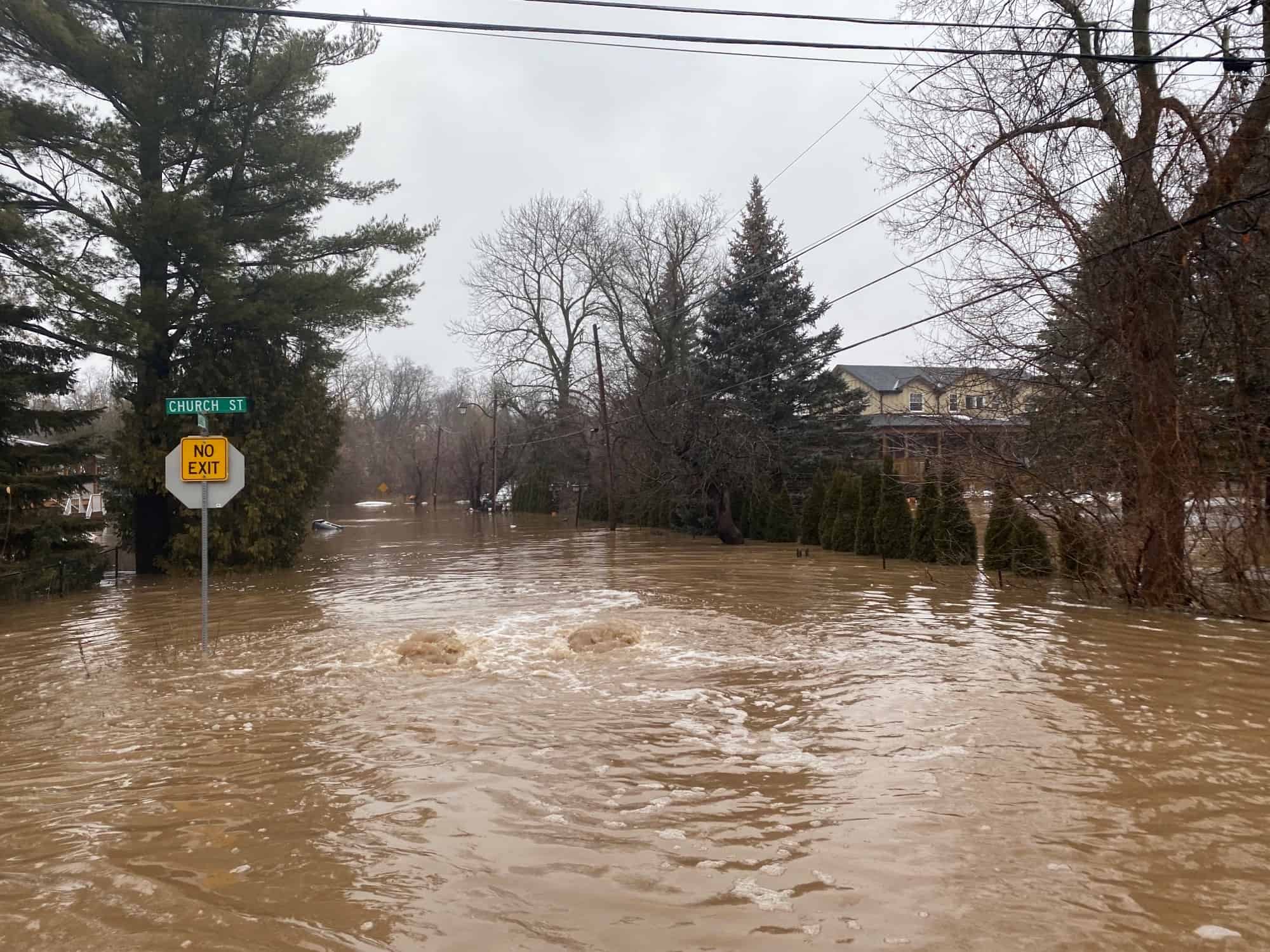
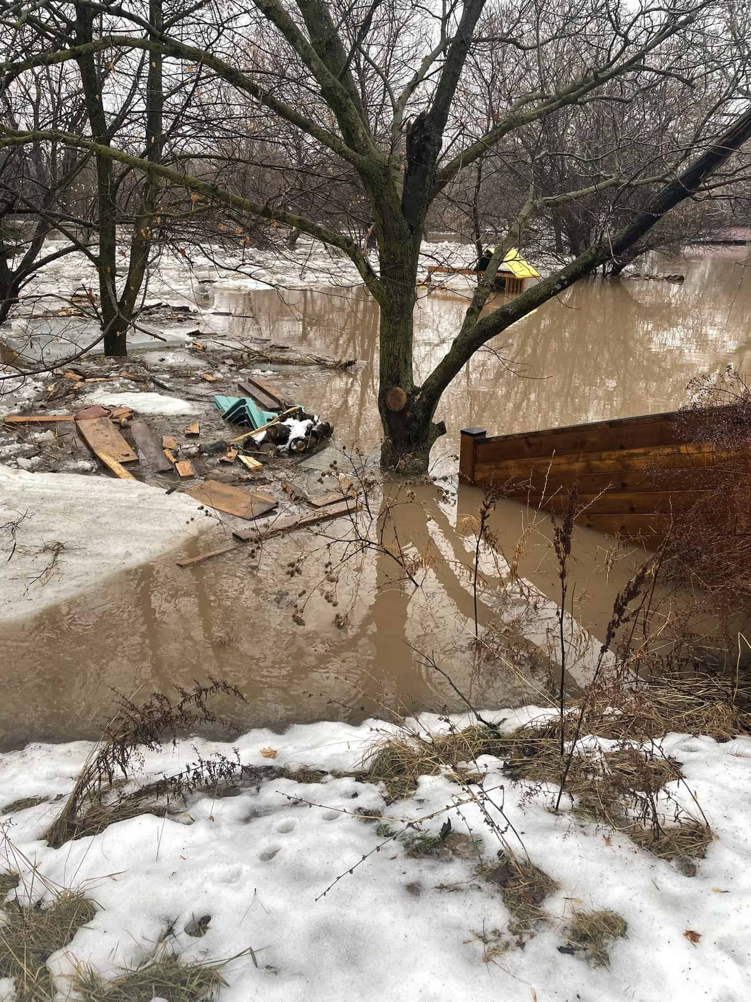
Some 100 homes in the area of Churchville Road and Steeles Avenue West were evacuated. And while police say there have been no injuries reported due to the rising waters, Brampton Fire Chief Bill Boyes said on Friday that the water level rose to about six feet deep in some areas.
Boyes said rescue boats and members of the Peel Regional Police Marine unit went door-to-door evacuating residents.
“We’re just very happy that all residents are OK,” Boyes said at a press conference on Friday. “We’re obviously concerned about their properties but we’re going to work with our public works team and all the stakeholders, our utilities here, to make sure that people can eventually get back in safely to their homes.”
Boyes said any displaced residents can call 3-1-1 for information or to access emergency services.
Please be advised of flooding in the Churchville Road area. Many roads in the area are closed. @BramptonFireES @CVC_CA @PeelPolice and @CityBrampton Public Works are on scene. pic.twitter.com/0AkDnst6yN
— Brampton Prepared (@BEMOprepared) February 17, 2022
On Friday afternoon, Brampton Mayor Patrick Brown said he’s been in talks with Ontario Premier Doug Ford about provincial assistance to help with the flood damage.
Brown said the premier is working with the President of the Treasury Board of Ontario and MPP for Brampton South Prabhmeet Sarkaria to make sure the support needed is available.
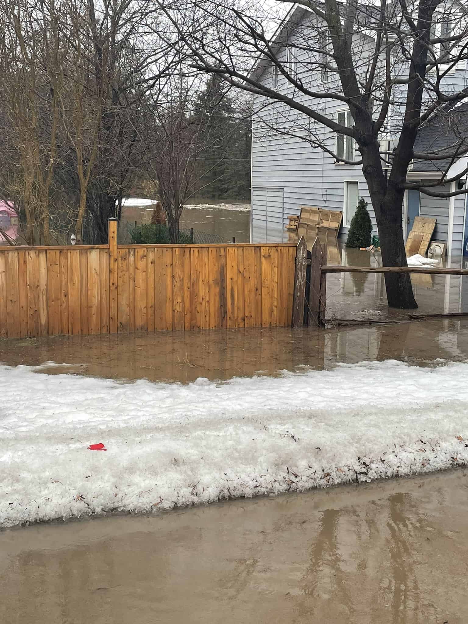
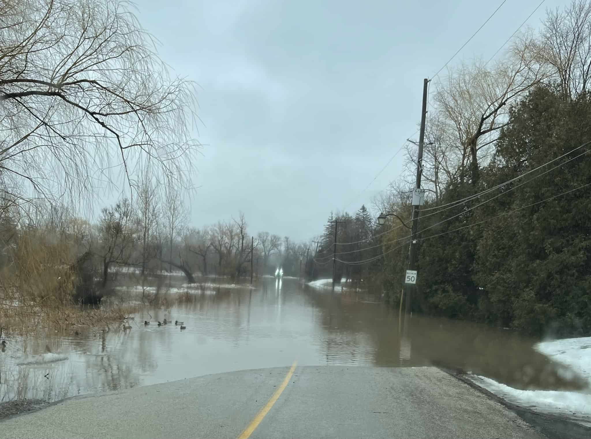
Photos of the area show rising waters across roadways, as well as spilling into Churchville Park South and onto people’s properties.
Regional Councillor Michael Palleschi said the Churchville area is one of the oldest and most historic in the city of Brampton.
Officials said they will be using a drone to assess the water levels and the damage.
City of Brampton crews remain on scene to respond to the ongoing flood situation.
Brampton Fire and Emergency Services is working in partnership with Peel Regional Police to ensure the safety of residents in the areas. pic.twitter.com/Kb6kozYpKG
— City of Brampton (@CityBrampton) February 18, 2022

INsauga's Editorial Standards and Policies


