The history of Derry Road and the neighbourhood in Mississauga
Published September 24, 2022 at 7:06 am
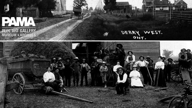
Around McLaughlin Road and Derry Road in Mississauga there are many places named that are “Derry-centric”.
You will see places like Derry West Village Public School, Derry Village Square plaza, Derrydale Golf Club, the Derry Village development.
The obvious answer is that they’re named after Derry Road, but you have to reach further back for its true origins.
Irish immigrants from New York set out for a new life in Canada, arriving in what now is north Mississauga in 1819. One of he settlers suggested that they name their farming community “Derry Walls”, in honour of the historic battle of Londonderry, Ireland.
They decided instead to choose Derry-in-the-West, which the post office shortened to Derry West.
The community grew rapidly, adding homes, a school, churches, a temperance hall, a cemetery, a hotel “where many a fight took place”, stores offering groceries and locally made shoes, a carpenter, and more. The community flourished, partially thanks to the fact Meadowvale residents had to go to Derry West for their letters and packages.
The community became such a success, that the road in and out became known as “Derry Road”. Unfortunately, a fire destroyed much of the community in 1865. Starting on one house’s porch, the fire spread thanks to a strong wind. Only a few houses survived.
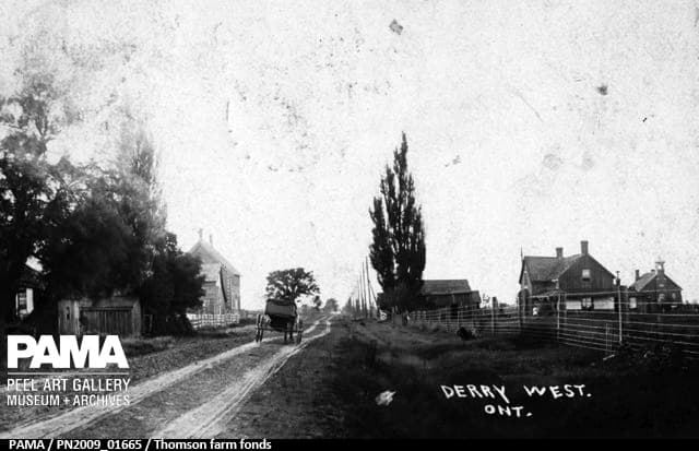
While the community was quick to rebuild its buildings, it never rebuilt its prominence. Another fire in 1873 destroyed a rebuilt hotel. A selection of buildings are seen here, in 1908, looking north on Hurontario.
What’s there today:
The Wedgewood family moved to Derry West around 1851, when the land was “mostly all bush”. In the 1860s, the family took mud from their farm’s pond to create bricks, and build a house. They surrounded these walls by red brick, made locally later on, meaning the walls were 76 centimetres (30 inches) thick!
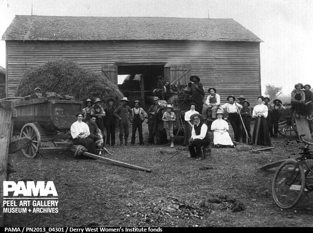
The photo below is of threshing day on the Wedgewood farm, around 1906. Joseph Sheard owned the steam engine seen in the middle of the photo—more about them later. Look inside the barn, and you’ll faintly see a grain tresher, and on the left, a water-tank used with the thresher.
Weird fact: in 1886,Bramptonbecame the centre of Presbyterianism in Peel with a new church. Derry West’s church building was no longer needed, and sold for $25 to the Wedgewood family, as a shed.
The Wedgewood farm is now the site of a marketing company that creates Barbie-branded strawberry juice, the Canadian Council of Hindus, and no less than four distribution warehouses.
What’s there today:
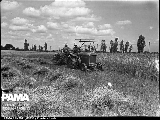
The Sheard family lived on the northwest corner ofDerryand Hurontario. While it’s hard to pin down where on the lot this was exactly, the utility poles (likely on Hurontario) suggest this spot on Edwards Boulevard might be a good guess. The photo shows the Sheards harvesting during the summer of 1940.
The family’s farmland included the site of the final Derry West school. For many years after it closed, the schoolhouse remained standing next to the Olympia Grill. As was the case with many Canadian families in decades past, the Sheard family’s house served as a post office. To pick up your mail, you’d stop by their house. Eventually, the family even built a garage (a mechanic’s and gas station).
What’s there today:
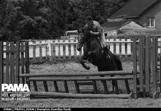
Even in recent decades, much of the area was agricultural. Heritage Farms was home to an equestrian riding program, seen during a 1982 competition. This particular farm was a few kilometres west of Derry West on 2nd Line West, between Steeles and Old Derry Road.
What’s there today:
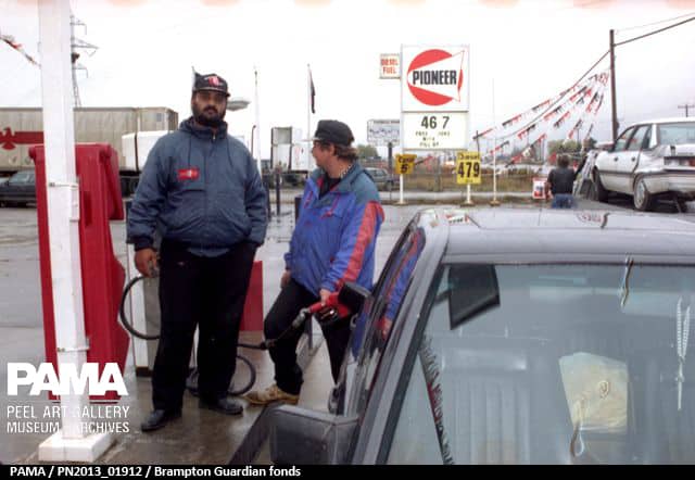
Can a gas station have a sex change? If you’ve filled up your car while heading north on Hurontario toMississauga’s border, you might have stopped at Good Guys gas station. As of 1994, when the Brampton Guardian photographed this image, it was “Girl’s Gas Station”. (How many of you can remember 46.7 cent/litre gas?)
What’s there today:
INsauga's Editorial Standards and Policies


