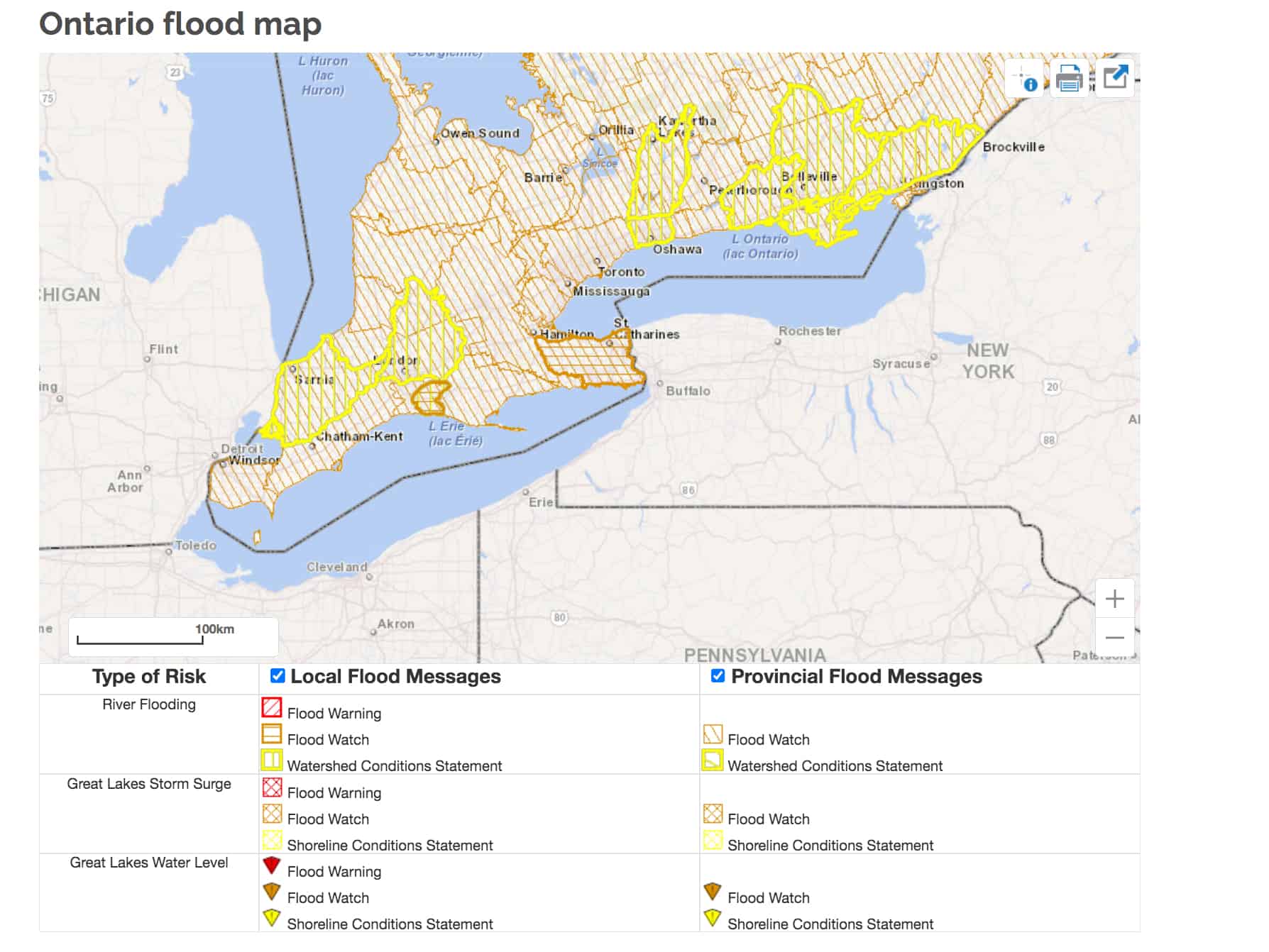
Flood watch issued for Mississauga, Brampton, Hamilton, Burlington and Oakville
Published December 30, 2022 at 11:19 am

After battling a nasty winter storm last week, much of southern Ontario, including Mississauga, Brampton, Hamilton and Halton Region is now under a flood watch.
In a reversal from last week’s frigid weather and winter storm, rain and warm temperatures are expected over the New Year’s Eve weekend and into next week.
Daytime high temperatures over much of southern Ontario from yesterday (Dec. 29) to Sunday Jan. 1 are expected to be 5 C or higher, according to the Province of Ontario Flood Forecasting and Warning Program.
This warmer weather, which will melt last week’s snow, along with accumulated precipitation amounts from 25 to 40 mm across the province, prompted a flood watch for much of southern Ontario including Mississauga, Halton Region, Hamilton and Niagara.
🌡️ Warmer temperatures are arriving over southern Ontario. Rain is also expected. 🌧️
Forecasts: https://t.co/KaVXMA1KUn
Ontario Ministry of Natural Resources and Forestry flooding information: https://t.co/1cKag1PzLT#ONwx #ONflood pic.twitter.com/zKSDEnk9wX
— ECCC Weather Ontario (@ECCCWeatherON) December 29, 2022
A flood watch means there is the potential for flooding, as opposed to a flood warning, which means flooding is imminent or already occurring.
“No major flooding is expected at this time,” the Ontario Flood Forecasting and Warning Program statement reads. “However, some watercourses may reach or exceed their banks, leading to localized flooding in floodplains, low lying areas, areas with poor drainage.”

A storm surge on Lake Ontario is not expected, but south-facing shorelines will see moderate continuous wave action over the forecast period which may increase erosion and unstable or hazardous slopes.
A close watch on local weather conditions is recommended.
For more information, visit the Ontario Flood Forecasting and Warning Program website or your local conservation authority.
INsauga's Editorial Standards and Policies

