Biggest rainstorm in a century was no match for this part of new LRT line in Mississauga
Published September 17, 2024 at 4:05 pm
A key part of the Hazel McCallion light-rail transit line in Mississauga’s south end has already shown it can withstand the impact of a one-in-100-year rainstorm, project leaders say.
An overhaul of a section of the century-old Mary Fix Creek as part of work on the $4.6-billion Mississauga-to-Brampton Hazel McCallion Line was completed earlier this year.
The section of Mary Fix Creek running from Old River Road to the Credit River is vital to preventing floods and erosion near Port Credit GO station, starting point of the 22-kilometre LRT line that’ll carry passengers between south Mississauga and Brampton when it opens sometime in 2025.
The creek underwent a “transformative revitalization as part of the Hazel McCallion Line project,” a Metrolinx spokesperson said earlier. Metrolinx is the provincial agency overseeing the massive public transportation project.
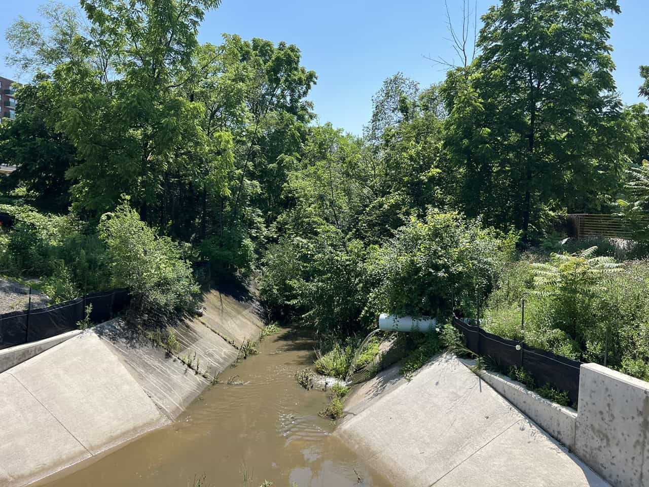
“Mary Fix Creek’s upgrade features 400 metres of reconstructed creek bed with walls built for a 100-year flood,” project leaders said in a post to social media. “It passed major tests during heavy rains this summer, including a one-in-100-year storm. The enhanced system effectively protected the area.”

A transformed section of Mary Fix Creek as it runs near Hurontario Street in Mississauga’s south end. (Photo: Metrolinx)
Work on both 100-year-old Mary Fix Creek and Etobicoke Creek is a major part of the Hazel McCallion Line project. The two watercourses were restored and revitalized as part of the huge transit initiative.


Restoration of both creeks also enhances the habitat for local wildlife, project officials said earlier.
Named for a local pioneer, Mary Fix Creek flows from the Mavis Road/Eglinton Avenue area in central Mississauga, then parallel to Hurontario Street south of the QEW before emptying into the Credit River at the CN bridge in Port Credit.
“This creek plays an important role in the city’s water infrastructure,” Metrolinx said earlier, noting work crews used extreme care around the creek.
Work crews reconstructed 400 metres of the creek bed, from just north of Old River Road to the GO station.
“This is a critical stretch for flood protection, where the creek flows through a concrete-lined channel,” project leaders said earlier. “The new design is going to be wider and deeper, which will provide additional flood control with up-to-date hydraulic modelling, improved safety and resilience, all while protecting the community from significant storm damage.”
Earlier this summer, work was also completed on a new bridge over Mary Fix Creek that’s expected to ensure smooth east-west traffic flow for vehicles travelling from one side of the Hazel McCallion Line (Hurontario Street) to the other.

Illustration shows new bridge spanning Mary Fix Creek (left). (Image: Metrolinx)
When completed sometime in 2025, the Hazel McCallion Line will run some 22 kilometres along Hurontario Street, starting at Port Credit GO just north of the lake in Mississauga and running north into Brampton with some two dozen stops along the way.
A handful of those stops will be in Mississauga’s downtown core by Square One Shopping Centre where plans for the “downtown loop” were restored earlier this year.
INsauga's Editorial Standards and Policies